




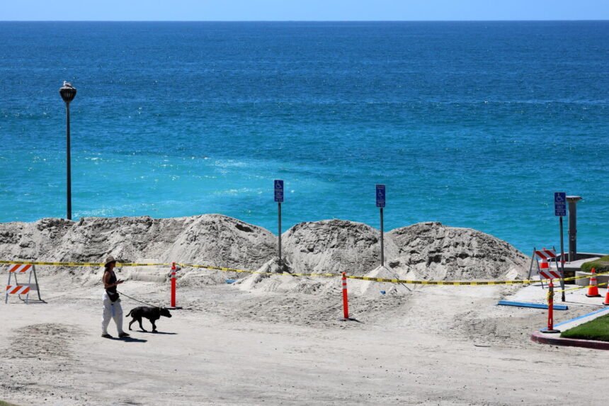
Southern California is preparing for a dramatic change along the coastline this Labor Day weekend as Hurricane Marie sends powerful ocean swells, dangerous rip currents, tropical moisture, and the possibility of rain toward the region.
- Powerful Surf Expected Along the Coast
- Rip Currents Could Present the Greatest Danger
- Rain Could Reach Parts of Los Angeles County
- Orange County Already Watching Its Coastline Closely
- The Hurricane Will Remain Far Offshore
- A Different Kind of Labor Day Weekend
- Southern California Watches Marie From a Distance
The center of Hurricane Marie is expected to remain well offshore and southwest of Southern California, meaning the region is not currently expected to experience a direct hurricane strike. Even from hundreds of miles away, however, the storm is expected to have a noticeable impact on beaches and coastal communities from Orange County through Los Angeles County and farther north.
The National Weather Service says surf generated by Marie will begin arriving along portions of the Southern California coast and is expected to build through the weekend, with some of the strongest conditions anticipated around Sunday. Elevated surf could then continue into Monday and Tuesday as the storm slowly moves farther away.
For millions of Southern Californians planning to spend the holiday weekend near the ocean, forecasters are urging caution.
Powerful Surf Expected Along the Coast
One of the biggest impacts from Hurricane Marie will be the ocean.
South and southeast swells generated by the tropical system are expected to produce significantly larger waves, particularly at beaches that face south. The National Weather Service is warning about strong rip currents and hazardous surf conditions throughout the holiday weekend.
Some forecasts indicate waves could reach approximately six to eight feet at exposed beaches, creating potentially dangerous conditions even in areas where the weather itself may appear relatively calm. Coastal flooding could also become a concern when the larger surf combines with high tides.
Locations including Malibu, Long Beach, Avalon, Point Mugu, and other low lying coastal areas could experience some of the most noticeable impacts.
The National Weather Service has issued coastal flood and high surf advisories for portions of the Southern California coastline as officials continue monitoring the incoming swell.
Rip Currents Could Present the Greatest Danger
For beachgoers, one of the most serious concerns may not be the size of the waves themselves but the powerful currents underneath them.
Rip currents can quickly carry swimmers away from shore and are particularly dangerous during periods of elevated surf.
The National Weather Service is encouraging people who visit the beach to stay near staffed lifeguard towers, remain away from rocks and jetties, and avoid turning their backs on the ocean when waves are elevated.
Even experienced swimmers can become overwhelmed by strong currents.
Southern California beaches are expected to remain popular during the Labor Day weekend, making awareness especially important as residents and tourists gather along the coast.
The unusual combination of warm holiday weather, tropical moisture, and powerful surf could create conditions that look inviting from shore while becoming significantly more hazardous once swimmers enter the water.
Rain Could Reach Parts of Los Angeles County
Marie may also bring another unusual element to the holiday weekend.
Rain.
According to the National Weather Service, tropical moisture associated with the storm is expected to move into the region, creating a chance for light rainfall on Sunday, particularly across Los Angeles County.
The rainfall is not currently expected to resemble the extreme precipitation sometimes associated with tropical systems that move directly into Southern California.
Instead, forecasters expect Marie to remain offshore while moisture from the storm reaches the region.
For residents who have spent much of the summer dealing with intense heat and dry conditions, the change could be noticeable.
Temperatures across much of Southern California are also expected to remain below seasonal averages heading into the weekend before gradually warming again next week.
Orange County Already Watching Its Coastline Closely
Concerns about the incoming swell are particularly visible in Orange County.
In Laguna Beach, a partially collapsed seawall at an oceanfront property has raised additional concerns ahead of the weekend.
The seawall was reportedly damaged during powerful surf and high tides in late August, and the approaching swell generated by Marie is creating renewed attention around vulnerable sections of the coast.
Southern California’s coastline routinely experiences erosion and damage during major swell events, particularly when high surf arrives at the same time as elevated tides.
The approaching conditions will provide another test for beaches and coastal properties that have already experienced repeated wave activity this summer.
The Hurricane Will Remain Far Offshore
Despite the heightened attention surrounding Marie, residents should understand an important distinction.
Southern California is not currently forecast to experience a direct hit from the center of the hurricane.
As of late Thursday and early Friday, National Weather Service forecasters continued to expect Marie to remain well southwest of the region through the holiday weekend.
That distance greatly reduces the possibility of the destructive winds associated with the core of a hurricane.
The ocean, however, can carry energy from a tropical cyclone across enormous distances.
That is why a hurricane located hundreds of miles away can still generate dangerous waves and currents along Southern California beaches.
Marine forecasts Thursday evening placed Hurricane Marie hundreds of nautical miles south of Los Angeles while continuing to move across the eastern Pacific.
A Different Kind of Labor Day Weekend
Labor Day weekend is traditionally one of Southern California’s busiest periods for beaches, coastal restaurants, hotels, and outdoor recreation.
This year, Hurricane Marie is adding an unusual tropical element.
Visitors could encounter everything from sunshine and cooler temperatures to tropical clouds, light showers, strong surf, and dangerous currents depending on where they are located and when they visit.
For surfers, the approaching swell may appear attractive, but officials continue to stress that larger waves can create stronger currents and unpredictable conditions.
For families, casual swimmers, and visitors unfamiliar with the ocean, staying close to lifeguarded areas could be particularly important.
Conditions can also change rapidly throughout the day as tides rise and individual sets of larger waves move toward shore.
Southern California Watches Marie From a Distance
Hurricane Marie may never come close enough to Southern California for residents to experience its hurricane force winds, but the storm is still expected to make its presence felt.
From higher surf in Orange County to dangerous rip currents along Los Angeles beaches and possible Sunday rainfall, Marie is shaping up to become one of the biggest weather stories of the Labor Day weekend.
The National Weather Service continues to monitor the system and its evolving effects on the region.
For Southern Californians, the message heading into the holiday is simple.
The hurricane may be far out at sea, but the ocean it is sending toward the coast deserves attention.
Beach visitors should monitor local forecasts, follow lifeguard instructions, respect posted warnings, and remember that some of the most dangerous effects of a distant tropical storm can arrive long before the storm itself is anywhere nearby.