



Southern California is heading into Labor Day weekend with sunshine, heat and beach plans on the calendar, but weather officials are urging residents and visitors to stay alert as Hurricane Marie churns over the Pacific and sends potentially hazardous conditions toward the region.
Although the hurricane is expected to remain well offshore, its influence will still be felt across parts of Southern California through the holiday weekend and into Tuesday. The National Weather Service is highlighting four primary concerns: dangerous rip currents and large waves, coastal flooding, chances for rain and unusually warm temperatures.
For millions of people planning to spend the long weekend at beaches, parks and outdoor events, conditions could change quickly depending on location.
Powerful Surf Raises Concerns Along the Coast
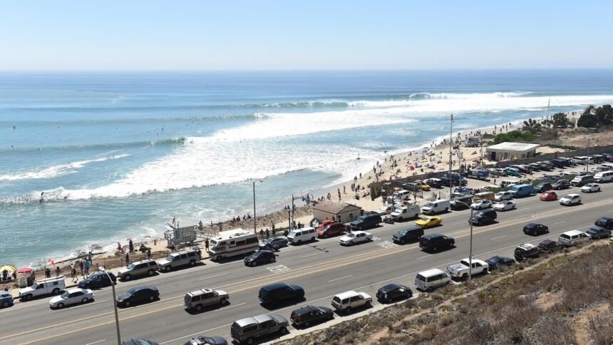
The most immediate concern will be along Southern California beaches, where strong swells generated by Marie are expected to produce larger waves and powerful rip currents.
Weather officials say the risk of dangerous rip currents will remain high from Saturday through Tuesday, creating potentially hazardous swimming conditions even at beaches that may appear calm from shore.
Rip currents can quickly pull swimmers away from the coastline and are particularly dangerous for inexperienced swimmers or anyone entering the water outside areas monitored by lifeguards.
Beachgoers are being encouraged to swim near staffed lifeguard towers, understand their swimming ability and avoid climbing onto rock jetties or other coastal structures while surf conditions are elevated.
The warning comes during one of the busiest beach weekends of the year, when Southern California destinations from Malibu to Long Beach typically attract large holiday crowds.
Coastal Flooding Could Affect Several Communities
The increased surf is also expected to create a risk of coastal flooding and beach erosion.
South facing beaches could experience shallow flooding, with water potentially reaching bike paths, parking areas and low lying roads near the shoreline. Significant beach erosion is also possible as repeated waves reach farther onto the sand.
Among the communities facing some of the greatest risk are Avalon on Santa Catalina Island, Long Beach, Malibu and Point Mugu.
The highest coastal flooding concerns are expected Sunday through Tuesday.
Visitors heading to these areas should pay attention to posted warnings and local conditions before setting up close to the water. Areas that are normally dry could become vulnerable as larger sets of waves move ashore.
Rain Could Interrupt Outdoor Plans
Southern California could also see an unusual dose of holiday weekend rainfall.
Forecasters are watching for moisture associated with Marie to move into the region, creating a moderate possibility of light rain and showers on Sunday.
Los Angeles and Ventura counties appear to have some of the better chances for rainfall, particularly from late Saturday into Sunday.
While the expected rain is not currently projected to become a major storm event, even light showers could affect outdoor gatherings, beach trips and holiday travel.
Roadways may also become slick after extended periods of dry weather, especially when the first rainfall mixes with accumulated oil and debris on pavement.
Rain chances are expected to decrease Monday and Tuesday as Marie continues moving farther north and weakens.
Inland Communities Face Holiday Weekend Heat
Away from the coast, heat will remain another concern.
Temperatures across warmer inland areas could reach the low to middle 90s between Saturday and Tuesday, adding another factor for families attending outdoor celebrations, sporting events or spending extended periods outside.
Coastal areas should remain comparatively cooler, but inland valleys and communities farther from the ocean are expected to feel the strongest heat.
Residents should plan for extra water, shade and breaks from prolonged sun exposure, especially during the warmest part of the afternoon.
The combination of elevated temperatures and changing tropical weather patterns makes this Labor Day weekend somewhat different from the typical late summer forecast.
Hurricane Marie Remains Offshore
Marie is expected to continue traveling north northwest over the Pacific while gradually weakening.
The storm is not forecast to make a direct landfall in Southern California. Instead, its distance offshore will still allow it to influence ocean conditions and push moisture toward parts of the region.
That distinction is important. Southern California does not need to experience a direct tropical storm or hurricane strike to see significant impacts from a system moving through the eastern Pacific.
Large swells can travel hundreds of miles from a storm center, while tropical moisture can move into the region and increase cloud cover and rain chances.
A Holiday Weekend That Calls for Extra Awareness
Labor Day weekend traditionally marks one of Southern California’s final major summer celebrations, bringing crowds to beaches, backyard gatherings, restaurants, amusement parks and outdoor destinations throughout the region.
This year, residents may need to keep a closer eye on changing conditions.
For those heading to the coast, the greatest concern will be the ocean. For inland communities, heat will be the bigger issue. And across Los Angeles and Ventura counties, clouds and occasional showers could add another twist to weekend plans.
The weather does not mean Southern Californians need to cancel the holiday weekend, but officials are encouraging everyone to remain aware of their surroundings and follow warnings as conditions develop.
With Hurricane Marie spinning well offshore, Southern California may get a reminder this Labor Day weekend that even a distant Pacific storm can make its presence felt from the shoreline to the valleys.